
 When one thinks of the Southwest, the desert comes to mind. Thoughts of dust, sand dunes,
cactus and tumbleweeds come from images in old movies and books. It's not the place
that first springs into your head when thinking of river rafting. Fortunately, Arizona
hosts some of the finest whitewater in the world. In years of decent snow, meltwater
brings to life the riparian areas along the Salt, Gila and Verde Rivers. It also swells
their flows making them (for a month or two) great Class 3-5 whitewater.
When one thinks of the Southwest, the desert comes to mind. Thoughts of dust, sand dunes,
cactus and tumbleweeds come from images in old movies and books. It's not the place
that first springs into your head when thinking of river rafting. Fortunately, Arizona
hosts some of the finest whitewater in the world. In years of decent snow, meltwater
brings to life the riparian areas along the Salt, Gila and Verde Rivers. It also swells
their flows making them (for a month or two) great Class 3-5 whitewater.
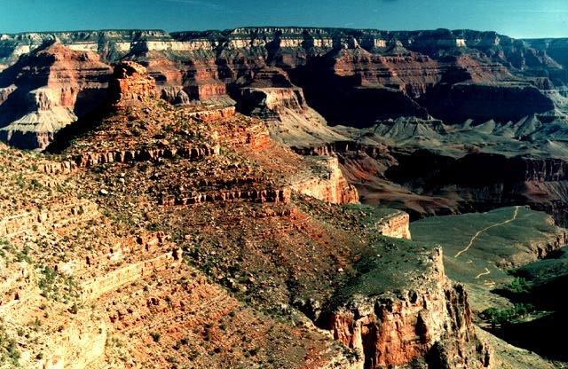
In addition to these seasonal rivers, the state contains the Colorado River. For over 200
miles, the Colorado winds through the
Grand Canyon
and hosts some of the most famous
rapids known to river runners - Hance, Horn Creek, Crystal and Lava Falls to name a
few. The river varies in depth from a few inches to more than 100 feet and is as narrow
as 76 feet at Mile 136 and widens to over 750 feet at Mile 193.
The distances on the river are measured from the Lee's Ferry put-in (Mile 0). Thirteen
miles upstream from Lee's Ferry is the
Glen Canyon Dam. Beginning
operation in 1962, the dam altered the entire Grand Canyon ecosystem. Water temperatures
have dropped an average of 20 degrees and sediment load, vital for beach replenishment,
has been cut off. The river now runs clear and cold where it once ran muddy and warm.
Being a geologist, I can only default to those specialists in biology, ecology, and
botany for the interpretation of the impact on the many species living within the Canyon.
The Colorado River drops 1,709 feet in over 279 miles, which is over 25 times steeper
than the Mississippi. The flow rate measured in c.f.s. (cubic feet per second), averages
about 10,000 cfs. This rate varies with changing energy requirements along the
Southwestern grid. The lowest recorded rate was 1,000 cfs in 1977 and the highest, 92,000
cfs in 1983. In the "Pre-Dambrian" days, highs probably exceeded 300,000 cfs!
Some of my favorite images and pictures:
 For the current flows of the Upper Salt River:
For the current flows of the Colorado River:
For more information on the state of rivers across the country, or if you
are interseted in getting involved in whitewater activities, contact these groups:
Or, check out these groups:
For more information on rafting the Grand Canyon:
Finally, current topics on paddling, rivers and general outdoor info can be
found the following Usenet newsgroups:
For the current flows of the Upper Salt River:
For the current flows of the Colorado River:
For more information on the state of rivers across the country, or if you
are interseted in getting involved in whitewater activities, contact these groups:
Or, check out these groups:
For more information on rafting the Grand Canyon:
Finally, current topics on paddling, rivers and general outdoor info can be
found the following Usenet newsgroups:
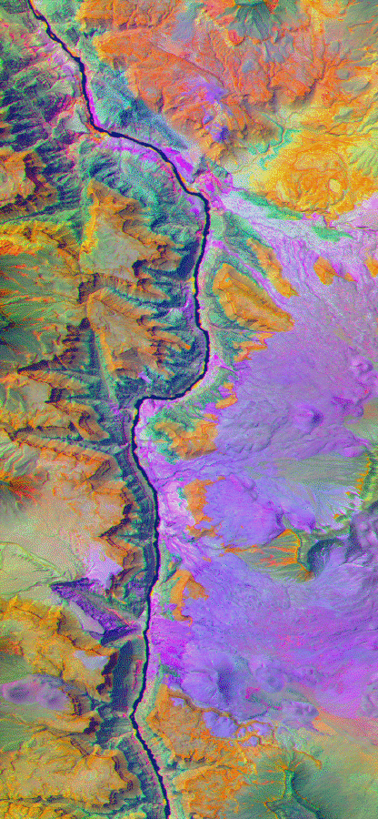
TIMS
image of Miles 176-184.
Caption.
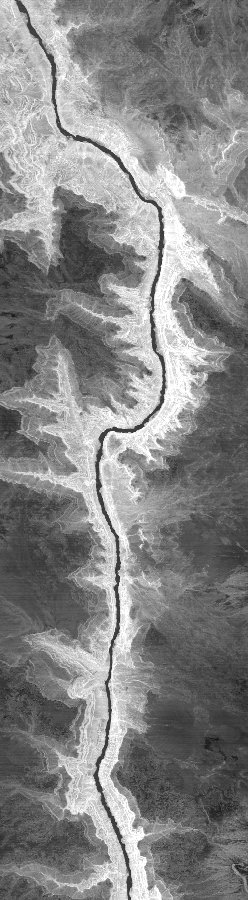
TIMS
pre-dawn image of the same region.
Caption.
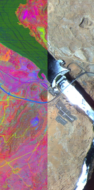
TIMS/NS001
composite of the Glen Canyon Dam in all it's *glory*.
Caption.
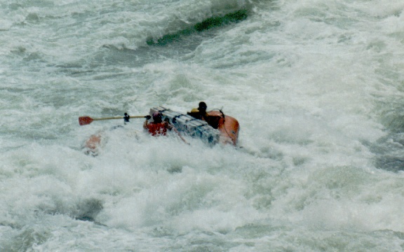
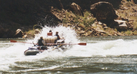
Picture of how to do a perfect run at
Lava Falls !! (that *is* me)
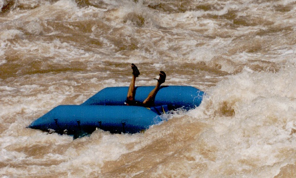
And, how to do a "less than perfect" run at
209 Rapid !!
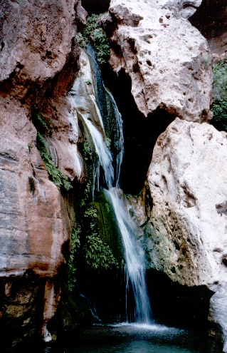
A photo of the best side canyon along the river,
Elves Chasm
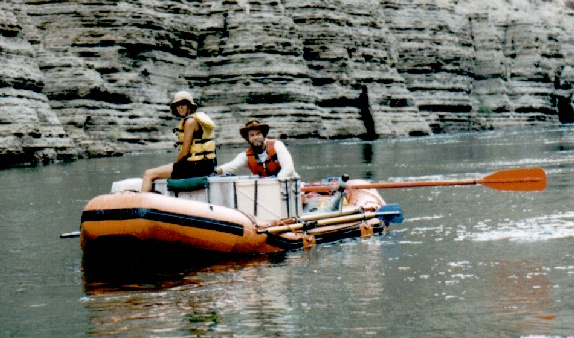
Picture of me looking every bit the "official"
guide
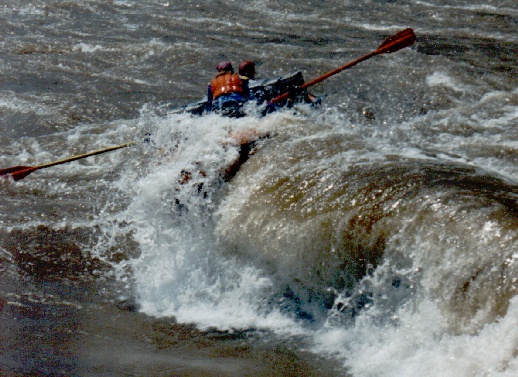
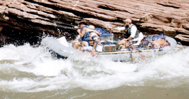
Picture of how to do a not so perfect run at
Lava Falls !! (my buddy Kimel)
Me hittin' the bottom hole at
House Rock Rapid.
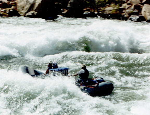
Me again running rapid
24.5 mile at 20,000+ cfs!
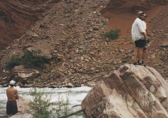
The scout of
Hance Rapid !! "You want me to run WHERE!?!?"
Me (yet again) runnin'
Nevills Rapid.
Here's a whole page of
pictures !! 
![]() Return to my home page.
Return to my home page.
Revised: September 24, 2001